Pacific Crest Trail Hike: OR & WA Section H – Mile 2149 – 2297
Pacific Crest Trail Hike: OR & WA Section H – Mile 2149 – 2297
Hello! This ended up being one of my favorite sections of the entire trail. It starts out with me walking across the Bridge of the Gods and ends with Goat Rocks Wilderness in Washington. I met back up and hiked with people that I care about deeply and am so thankful I got to share these experiences with them. This was a longer, action packed, section so forgive the long narratives and copious pictures!
PCT OR & WA Section H Summary
Statistics:
Days: 7
Full hiking days: 5
Zeroes: 0
Neros: 2
Total Trail Miles Hiked: 128
Total Miles Hiked: 130.4
Trail Elevation Gain: 25,629 ft
Trail Elevation Loss: 21,153 ft
Highlights:
Goat Rocks Wilderness with my Sierra Squad.
Crossing the Bridge of the Gods.
Community help in relation to navigating an active fire.
Bags’ family providing trail magic!
Lowlights:
Insomnia like I have never had before.
Personal life distracting me from enjoying the trail to its full extent.
PCT OR & WA Section H Detailed Version
Day 134: Mile 2149.7 – 2159.9
Trail Daily Miles: 10.2
Total Daily Miles: 10.7
Total Trail Mileage: 2159.9
Elevation Gain: 3461 ft
Elevation Loss: 790 ft
Weather: Hot, Humid
Overall Day Sentiment: Welcome to Washington!
After a wonderful time in Portland, I needed to head back to the trail. I left Beth’s early in the morning to catch one of the shuttles from Portland to Cascade Locks as I had plans to meet up with Prick, Bags, and RedRoy. The shuttle was as quick and pleasant as my way into town and before I knew it, I was outside of the post office with the group.
None of us were in any sort of hurry, so we all decided to head to Thunder Island Brewing for an early lunch (11am) and a drink to celebrate soon crossing into our last state. During our extensive time at the brewery, our dear Bobcat met up with us! After an illness caused a separation way back in Mammoth Lakes, it was wonderful to see him again! We filled each other in on how the trail had been treating us. After not seeing him for awhile, and vice versa, we realized how much weight we all had lost.
Eventually, several hours later, myself, Prick, Bags, and RedRoy headed out to cross the bridge. Bobcat wanted to stay in town overnight to do the usual chores before going into Washington. (Don’t worry, I will see him again!)
As I had driven over this bridge the year prior, this was a surreal experience to walk across it. We were gifted clear skies, beautiful water, and only a bit of traffic to manage. It was windy up there but with Hood River, Oregon being a kite surfing destination, we should have known. The wind was also a gift though as the day had turned out to be hotter and more humid than we anticipated. The open grates of the bridge were a bit nerve-racking but I was filled with such joy, that nothing else particularly mattered.
Knowing I had wanted to do the trail for four years, these specific pivotal moments and milestones had played out in my mind countless times. I’m so thankful I crossed with close friends rather than alone. It really is about the people you meet along the way.
After officially crossing into Washington, we were greeted with a sincere incline for the remainder of the day. Our goal was only around 10 miles as we had spent more time than we thought at the brewery. At about the halfway point, there was a beautiful lake that was too tempting to pass up. As mentioned, it was hot and humid so this lake was a must. A quick swim cooled us down enough for the rest of the incline.
This section was busy with weekend hikers, section hikers, and of course thru hikers. This limited where we could camp because by the time we were nearing spaces to camp – they were full! There were also limited water sources in this particular stretch and the last water source was down a steep embankment. There were a few other older hikers there that I assisted in gathering water because the angles were plain awkward to get the best flow.
Bags was struggling with her new sun hoodie as well, as I previously had experienced. It was not breathing properly and made the impact of the heat/humidity more severe. After a bit of rest and water to counteract the stifling material, we continued on to find a site. RedRoy and I picked out flat areas on the side of a dirt road. Don’t be fooled by some of my pictures, some tent sites were not scenic at all – like this one!
We all had dinner together on this old forest road and tucked in for the night after planning out the next day. My insomnia remained a problem, but at least I toiled with mostly happy thoughts of crossing the bridge.
Day 135: Mile 2159.9 – 2184.8
Trail Daily Miles: 24.9
Total Daily Miles: 25.5
Total Trail Mileage: 2184.8
Elevation Gain: 4123 ft
Elevation Loss: 6004 ft
Weather: Sun, Hot
Overall Day Sentiment: Hi Bags’ family!
This day was relatively status quo until a surprise at the end of the day. There were many berries in the section along with more road crossings of forest roads than I realized, which meant the trail was busy with day hikers. There were some longer stretches without water around 7 to 8 miles but nothing like we had seen in Northern California or Oregon.
At some point in the morning when I was cruising along, I ran into a group of hikers that I would continue to run into for the remainder of the trail. They were looking for a friend that they thought was behind them, but turned out might’ve actually been in front of them. This was a great reminder to make sure that anybody that you are hiking in a group with has your satellite communicator device phone number. In addition having a clearly communicated plan of where you all will meet, where you all will camp, and any communication in between.
I passed over several large rivers, one of which was known for being a swimming area. But because this area has such great road access in comparison into other wilderness areas, this swimming hole was taken over by locals. It was great to see families out, enjoying the summer weather and the beautiful scenery while swimming.
The day culminated in us hopefully camping at the Panther Creek campground because Bags’ family wanted to provide us trail magic this evening! I was the first to arrive at the destination for the evening so I went to the Panther Creek Campground host to check in to see if there were any non-claimed sites that we could be in. The deal is if there are any unclained or open sites, PCT hikers are allowed to camp there for a nominal fee, but several of us could be at the same site. Unfortunately, there was nothing available.
I went just a bit further on trail to find a spot for myself, Prick, Bags, and RedRoy. I did not want to go any farther than this tiny forested section because there was going to be a large incline greeting us the next morning and I did not feel like doing that at the end of the day. So I found us a few spots right near the river that turned out to be okay. This section would eventually fill up completely so I was thankful we got any sites! I went back to the road to intercept RedRoy, Prick and Bags to let them know about the update about the Panther Creek Campground, where are site was located, and to prepare for Bags’ family’s arrival with trail magic treats.
After we all got set up, Bags’ family arrived with a ton of pizza, including a gluten-free pizza for me! Did I actually shed happy tears when her mom handed me this? Yes. We all sat on the side of the road, that headed into the campground, and enjoyed a meal together. The highlight for Bags’ was not only seeing her family, but they also had brought her a new sun hoodie to replace her unbreathable sun hoodie that she had just gotten in Cascade Locks.
I’m so thankful that we had trail magic and got to meet her family, though I had already met her brother in Bend because it is fun to solidify trail friends as real life friends. It also is probably helpful for her family (or anyone’s family) to meet hikers because of the amount of time with spent with their loved ones in addition putting faces to our wild trail names. Because I was not initially expecting a whole gluten-free pizza to myself, I had now overpacked food, which allowed me to eat a lot in the coming days, which was a very welcomed treat.
After Bags family left we all tucked into our tents and listen to the sound of the river. My insomnia was slightly better this night, probably lulled to sleep by a full pizza in my stomach and the loud sound of the water.
Day 136: Mile 2184.8 – 2211.0
Trail Daily Miles: 26.2
Total Daily Miles: 26
Total Trail Mileage: 2211.0
Elevation Gain: 6367 ft
Elevation Loss: 2487 ft
Weather: Sun, Bugs
Overall Day Sentiment: Joy
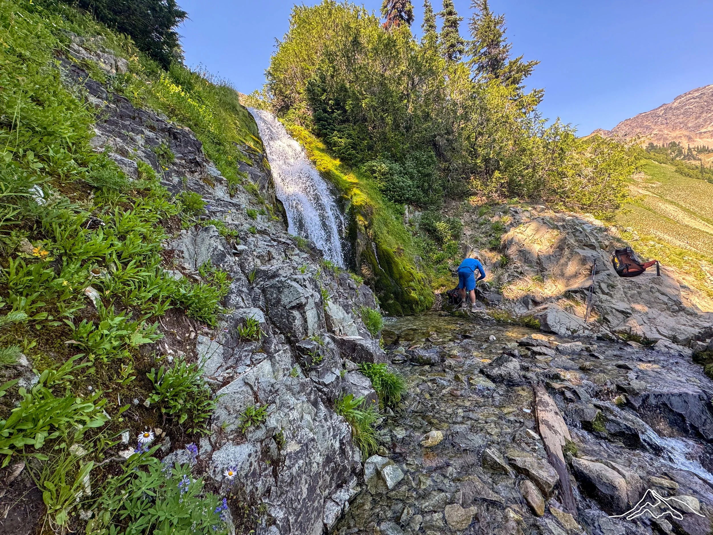
I woke up in my campsite next to the river with much condensation on my tent again. I packed up my wet tent and damp sleeping gear and began the long ascent up the climb that I had dreaded the day before. This was one of the longer endurance climbs of the entire trail with over 3000 feet of elevation gain over the course of 6 miles. Doing it in the morning is helpful for me because that’s when my legs are most rested, I have the most energy, and I’m most optimistic. Though this was an intense climb, it was forced and then pocket views of the surrounding peaks.
Bags, Prick, RedRoy, and myself decided on a general place to camp for the night so I decided to just move along and move at my own pace for the day. At some point I continued to trail jog on descents and flats until I arrived to mile 2200. Yeti had told me that he had left trail magic around this spot and so I took a beverage and posted up at a picnic table and had a lovely lunch at the 2200 mile mark. There were more climbs on the back half of the day but much more spread out as in comparison to the first ascent of the morning.
I arrived to the tentative camping spot early around 4pm and set up camp next to a small pond. But then was swiftly attacked by swarms of mosquitoes and biting flies, so I didn’t set up camp fully. I was mostly just hiding in the mesh part of my tent until Prick, Bags, and RedRoy arrived. I got a satellite communication message from Bags and she wanted to go a little bit further than I had stopped so I packed up my tent (not even full camp because again I had not sat all the way up) and hiked another 1.1 miles down the trail. This would set us up to be under 20 miles into Trout Lake the next day, which would be a solid half day of hiking on the clock.
I set up a full camp at a beautiful lake just off the trail and though there were still bugs there was less than my original camping spot. Eventually Prick, Bags, and RedRoy made it to the spot along with a section hiker that recently had started at Cascade Locks. It was a fun evening of answering 20 questions that this hiker had for people who had been out for over four months and had just crossed the 2200 mile mark. He was dealing with a lot of foot and blister problems which brought me right back to the desertand I had nothing but empathy and some mild suggestions for this person.
When I reflect about this night, I think about all of us just giggling, Bags and I somehow singing to each other from our tents, and scouring for berries. It was just such a lighthearted night, knowing that we were heading into Trout Lake the next day and we were just happy to be in Washington.
Day 137: Mile 2211.0 – 2231.6
Trail Daily Miles: 20.6
Total Daily Miles: 20.6
Total Trail Mileage: 2231.6
Elevation Gain: 2639 ft
Elevation Loss: 3491 ft
Weather: Sun, Smoke
Overall Day Sentiment: Proud of my speed; confused by the fire
The day started much earlier than I had planned because a surprise storm came in the night. Because of the heat, I had not put my rainfly on to allow proper airflow. Well at approximately 2:30am, a thunderstorm began and I was woken up with rain droplets hitting my face. I somewhat quickly (how quickly could I be moving at 2:30am after just falling asleep?) and put the rainfly on from within my tent. Yes, I was so cozy that I grabbed my fly, opened up both sides of the tent, and scooted it across the top so it was draped. And that is all I did… just draped it. I knew I was heading into town and could dry it there, so I couldn’t care much more than that.
My departure was around 5am anyway as I wanted to catch the 12:30pm shuttle from the trailhead into Trout Lake. I had sent myself a resupply box for the next stretch and planned to stay the night. This was pretty easy trail and I was feeling good so I trail ran a bit. Again, not to be confused with actual running, just 10-12 min mile pace.
I ran into Yeti and we hiked the last 5 miles until the road crossing that would go into Trout Lake together. As mentioned, I had planned on getting the 12:30pm shuttle into Trout Lake but there happen to be some day hikers there that we’re going into town and they took three hikers into Trout Lake. Yeti continued on because he did not need a resupply whereas I did need to go into town. But this ended up being one of my fastest hiking days of the entire trail; 20.6 miles by 11:30am!
When I got to Trout Lake, I picked up my resupply box and was looking around hopeful for another box that had been left for me. The hiker that had taken my second batterybank told me that they left it at the Trout Lake store. Though it was buried deep in the stacks of boxes I eventually did find it. This was such a highlight because this meant that I could freely listen to my audio selection, even on longer stretches in the backcountry.
I got many snacks at the Trout Lake store, which is the main hub of this small town, and sat with at least 20 other hikers while I ate them. You are allowed to camp near the store and there are some services there as well (charging, laundry, showers). Though I had already booked a room at the Trout Lake Valley Inn and was looking forward to the amenities.
While I was first in my hotel room, Yeti texted me a picture of a small plume of smoke that he was walking by. This small plume of smoke turned out to be the Mine Fire and would continue to grow in size throughout the day. This fire would also change the trajectory of many hikers paths. Prick and Bags arrived in town later in the afternoon and we discussed what to do about the Mine Fire because it has grown over the afternoon and became a serious problem by the evening.
There are Shuttle sign ups to get back to the trail via trail Angels at this at the store in town, so we made sure to sign up for the earliest one the next day to ensure we could get back on trail. Throughout the evening, there are rumors of the trail closing, Forest Service Rangers turning hikers around at the trail junction, and more trail lore. Unfortunately, this situation does not help my insomnia, and though I’m in one of the coziest rooms that I have ever been in on the trail, sleep evaded me.
Day 138: Mile 2231.6 – 2253.7
Trail Daily Miles: 2.7
Total Daily Miles: 2.7
Total Trail Mileage: 2253.7
Elevation Gain: 306 ft
Elevation Loss: 362 ft
Weather: Sun, Smoke
Overall Day Sentiment: Feeling lucky!
I woke up nervous for what the day would entail because the fire had grown a lot overnight. I was in contact with Bags early in the morning because she was at the store, which is where all the news was coming in about what next steps were. This day would end up being one of the most stressful days on trail because information was changing minute over minute and hour by hour. There were going to be no shuttles to the trailhead because going north on the trail had officially closed so we had to figure out how to get to the next spot that was open and accessible by road.
While the group was figuring this out at the store, I remained at the hotel, enjoying the breakfast buffet and eating all of my concerns. Because the last night on trail, I had been surprised by that sudden thunderstorm it took a long time for me to pack up my hotel room because everything had been laid out and drying.
I eventually made my way back to the store where there had to be at least 30 hikers congregated making a plan for the day. This also included our dear friend Bobcat, who was now looped into the plan moving forward as well. We were told several different things over the course of a few hours because the trail was officially closed which included, but not limited to;
A potential large bus taking everybody up to White Pass
Trail Angels bring you back to the trail, except 20 miles a little a bit north and you would hop on at Potato Hill
Go back to Cascade locks and then get a bus all the way up to White Pass or Snoqualmie Pass via Seattle
We were really hoping for option number two that would take us up forest roads via trail angels to Potato Hill. Because this would set us up to see and hike through Goat Rocks Wilderness in Washington, which is one of the most scenic spots on the entire Pacific Crest Trail. Most of the afternoon this unfortunately was not an option because the Forest Service had closed those roads and quite literally barricaded them.
So the four of us; Prick, Bags, Bobcat, and myself sat at the only diner in town and ate our feelings through a huckleberry milkshakes. The other options of jumping to White Pass were heartbreaking because then you would miss Goat Rocks Wilderness and have to hike southbound if you wanted to experience it and then hike back out north. Because I had already dealt with so many fire problems this season which forced me to bump around a lot more than I had originally planned. The thought of missing Goat Rocks was heartbreaking. In fact, I cried, Bobcat and sold me, and it felt like the desert again.
While we’re sucking down our huckleberry milkshakes, another hiker comes up to our table and says be at the store in 15 minutes because the Forest Service has allowed a caravan of of cars to go through. So we go to the store at the aforementioned time and this information turns out to be correct and the Forest Service was allowing five Trail Angel cars full of hikers to be allowed past the barricade. This would set us up jump back on thePCT at Potato Hill going northbound essentially just skirting the active fire zone.
The four of us could not have moved faster into these cars and a trail angel gave us all rides up some very rustic* (re: bumpy) forest roads for over an hour to get to the new jump on point. This was late in the day so we had just determined to hike a small amount of miles (under 3 miles) to an open field that had a water source that would set us up to hike through Goat Rocks Wilderness the following day.
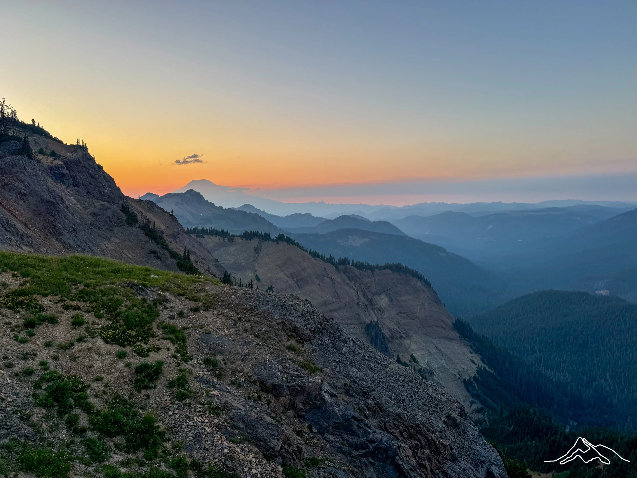
Everyone else had this plan as well and it ended up being a hiker party of around 20 people. You can see how many people are there in a little bit more detail of the situation in slides YouTube video linked here. Bags and I are interviewed so you can get a full scope of what we went through as well 🙂 Though I was surrounded by my dearest trail friends and the best case scenario with the fire in relation to my hike worked out, insomnia wouldn’t leave me alone this night either. I did take a good photo of the beautiful stars because I was in an open field, but it turned a bit eerie because you could see the glow from the fire, you can see this in a picture down below.
Day 139: Mile 2253.7 – 2282.3
Trail Daily Miles: 25.9
Total Daily Miles: 26.2
Total Trail Mileage: 2282.3
Elevation Gain: 5561 ft
Elevation Loss: 3822 ft
Weather: Sun
Overall Day Sentiment: Stunned
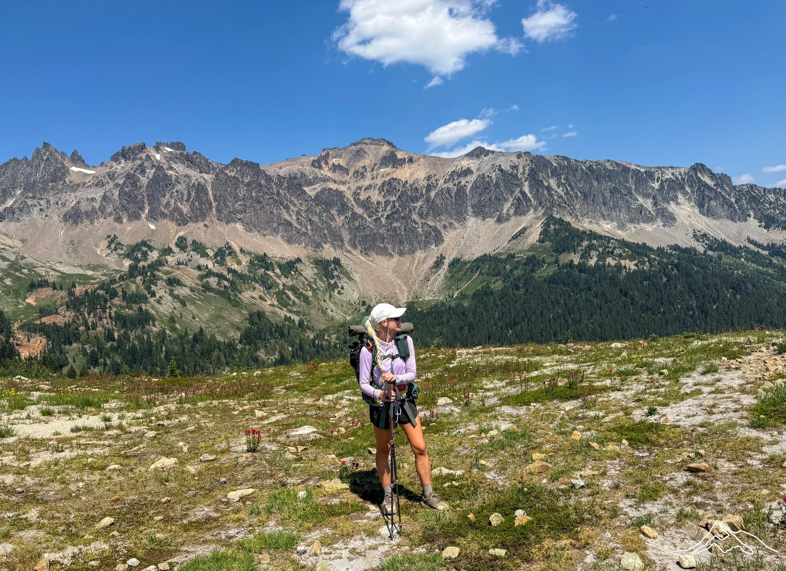
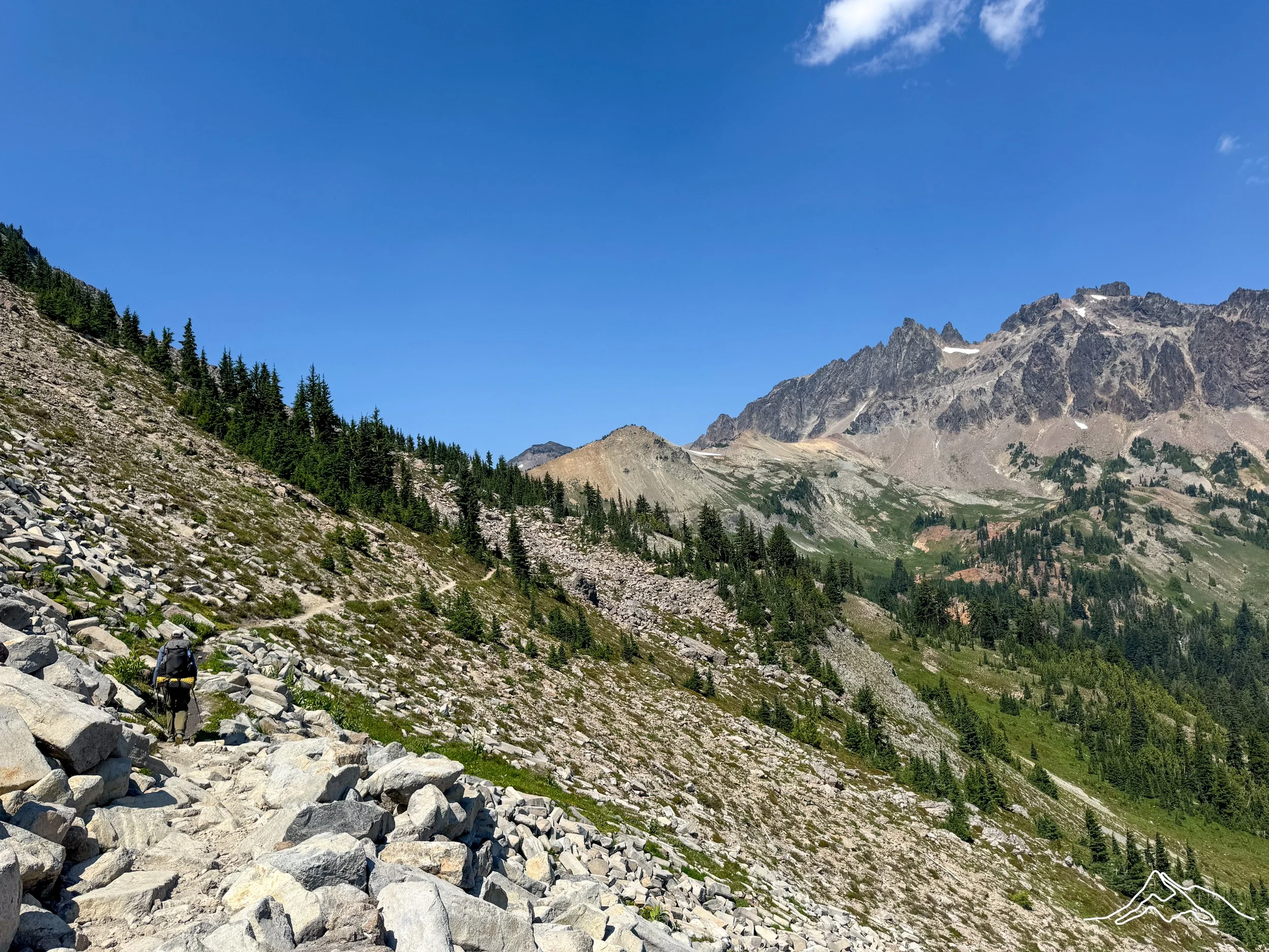
On this day, I would enter one of the most scenic areas on the entire Pacific Crest Trail, Goat Rocks Wilderness in Washington. This area is known for open views and trail that you can see for miles amongst impactful geological features. Myself, Bobcat, Prick, and Bags hiked out together and wanted to do this section as a group.
The main Goat Rocks Wilderness section wouldn’t start for several miles, so Bobcat and I headed out and hiked together, a call back to the first 900 miles of the trail. Bobcat and I chatted about how the trail had been going for each of us, how life outside of the trail had been going for each of us, and our primary conversation was around trail legs.
Trail legs are something that you hear of before the trail on the trail and from other people who interact with the trail. So Bobcat and I dissected what our actual trail legs were and what makes them so great. Trail legs are your legs that can go forever. The level of endurance that trail legs provide I never thought possible. What this means is that they can keep going for far longer than my mind thinks they can keep going. This was evident on my 40 mile day in which though my energy was low my legs didn’t actually hurt that much after 40 miles and significant elevation gain.
In addition to just endurance obviously we are having a lot of weight on in our packs while going up and down in elevation, creating some strong muscle as well. When you go over this uneven to rain with a backpack, you are also perfecting your stabilizer muscles. And lastly, one thing that surprised me the most was that my reflexes in general had become much quicker. Had I not had improved reflexes, I would’ve fallen on my face exponentially more times than I did. Don’t get me wrong. I still tripped, fell, or rolled my ankle several times, but it would’ve been much more impactful and frequent had I not had improved reflexes. This conversation made me want to keep my trail legs and body forever, but I know that it is not sustainable.
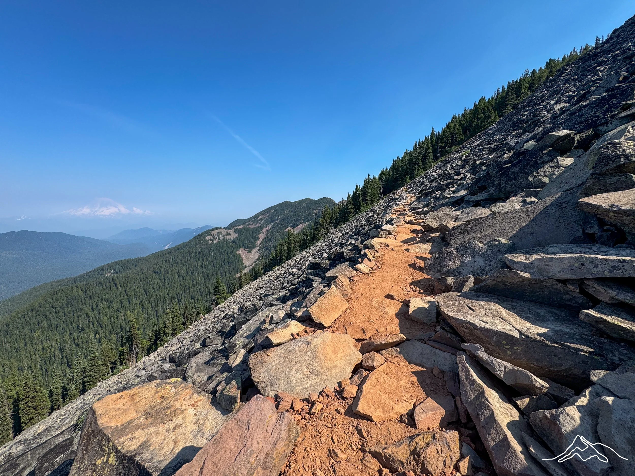
Some of the inclines in the Goat Rocks Wilderness leading up to the main most picturesque area were steep enough that I thought I was on the Appalachian Trail. Throughout this section, some of the trail opened up into wildflower meadows. It made me think that this is what the Sierra Nevada would look like in prime season as in comparison to when I went through completely in snow. The open views, the craggy rocks surrounding in the dramatic elevation gain was reminiscent of life 1500 miles ago.
Bobcat and I waited at the base of the knife’s edge climb for Prick and Bags. We did run into a few patches of snow which made us giggle and whine thinking about our time in the Sierra. Eventually, we headed up the rocky incline to get to the top of the knife’s edge before we followed the trail and descended amongst the ridge of these beautiful peaks.
I can’t fully explain the impact this day had on me because being with this group of people who I had not met five months ago, going through some of the most beautiful terrain I will ever see in my life while knowing that I had hiked here from Mexico was completely overwhelming. Walking in the back of our group of four was intentional so that I could stop and take the moments to be fully present.
I hope that some of the photos below can give some of the essence of what this wilderness area can provide. There were also a lot of day/weekend hikers in this area in addition to the thru-hikers because it is so beautiful. It is also relatively accessible from Highway 12 and if I lived in the area, I would be here frequently.
After the main knife’s edge section, we found a flat meadow that we camped in with a great water source. We had dinner up on the top of a rock watching the sunset go down over these peaks and it was a moment to just be thankful for.
Day 140: Mile 2282.3 – 2299.8
Trail Daily Miles: 17.5
Total Daily Miles: 18.9
Total Trail Mileage: 2299.8
Elevation Gain: 3172 ft
Elevation Loss: 4197 ft
Weather: Sun
Overall Day Sentiment: Thankful
I woke up early in order to get to White pass because I had an important phone call to have at a specific time. Because my insomnia was the worst it had been this night, I honestly probably only passed out for about an hour and then begrudgingly got up and started hiking.
This section into white pass was mostly a descent, which allowed me to go quicker than I originally anticipated which was good. There wasn’t too much of note in this section from coming down from the knife’s edge in Goat Rocks Wilderness to White Pass, but it was beautiful nevertheless. It went over rocky areas, forested trail, and was completely clear.
Once I hit the highway heading into White Pass there was trail magic but I was behind schedule for my phone call so I wanted to get set up there and prepare. Due to fires in this area, this highway going one direction was closed and had been closed for a while so I didn’t know exactly what I was walking into. Pedestrian traffic was allowed on the road from the PCT to the White Pass service area, but there was going to be less hope of getting a hitch into Packwood, Washington. Originally, I had thought about taking a zero in Packwood, but with the Trout Lake and Mine Fire debacle I no longer felt like I needed to have a zero here.
Once at the White Pass service area, it was a gas station and convenience store that had a lot of hiker services. This service provider, Krackerbarrel, accepted hiker boxes so I did have a box waiting for me. They have a giant shipping container that they designate for hiker boxes only. They do have showers and laundry on site, but with the bubble of hikers being moved around from both the fire near here and the Mine Fire near Trout Lake, everyone was pushed up to White Pass.
It was a busy spot with probably 30 hikers there during my time there. The moving around due to fires meant that there was a lot offered in the hiker box (a la Shelter Cove) which I donated a lot too because I had overpacked with my box being sent here and 20 less miles being hiked in this section. I eventually had my call and then I talked to my parents while I had good cell phone service.
Bobcat, Prick and Bags were all there amongst many other hikers making a plan of what to do in the next section. We were also informed that there was a fire near the Canadian border that threatened to close the border at this time. The thought of getting over 2200 miles in and not being able to tap that border was too much for me to think about, and so we eventually made a plan that led to a convoluted remainder of the miles in Washington.
Bobcat lives in the Washington area and wanted to see his partner so he headed out a few hours before Prick Bags and I did. It was wonderful to hike with him again and it felt like a perfect bow on my PCT experience to see him more towards the end in addition to all of the time that we spent together in the beginning in the middle.
Eventually, Prick Bags and I headed out and formulated a plan for the rest of the trail together, which will explain why my next few posts may be a little bit out of trail order or chronological order. Once we walked back to the trail along the road that was desolate from any cars as it was closed to vehicle traffic, we only hiked a few more miles to a lake, but it was all uphill. We got to the lake and it was a little too chilly to swim at that point, but we settled in to a beautiful campsite where there were other weekend hikers and other thru-hikers.
Another night of insomnia would greet me, but at least I had good friends and a plan to finish out the Pacific Crest Trail.
xoxo Kanga/Leeann