Pacific Crest Trail Hike: CA Section B – Mile 110 – 209
Pacific Crest Trail Hike: CA Section B – Mile 110 – 209
Hi again from the Trail! It feels like I just completed the PCT Section A and now I have already completed the PCT CA Section B! This section has some hard days for a variety of reasons; body pain, heat, route alternates, and more inclement weather.
In this section and sections beyond, there will be some trail closures and suggested closures from the PCTA. I’ve decided that though I am hiking with other people, if I do not feel confident in a section to do it alone, I will find an alternative route. This may hurt the trail purists, but I am here to complete the trail and live a long healthy life afterwards. I do not want to get myself in a situation I cannot get myself out of.
I did as many miles as I could have in this section with the alternates and the quantity of miles remains nearly identical to the trail miles. Safety first, folks!
PCT CA Section B Summary
Statistics:
Days: 7.5
Full hiking days: 5.5
Zeroes: 2
Neros: 0
Total Trail Miles Hiked: 97.5
Total Miles Hiked: 95.1
Trail Elevation Gain: 16026 ft
Trail Elevation Loss: 17622 ft
Highlights:
Getting some relief for my feet in the form of new and bigger shoes.
Pushing consistently longer days and having my body (besides my feet) react well.
Continuing to meet wonderful people along the way.
Meeting Idyllwild’s Mayor Max!
Lowlights:
Foot pain continuing beyond what other hikers are dealing with. Ouch.
The heat beginning to creep up, therefore shifting my waking time up.
Long water carries make pack weight increase exponentially and therefore my mid back hurts badly.
PCT CA Section B Detailed Version
Day 13: Mile 112 – 126.7
Trail Daily Miles: 14.7
Total Daily Miles: 14.9
Total Trail Mileage: 126.7
Elevation Gain: 3207 ft
Elevation Loss: 1133 ft
Weather: Sun, Hot
Overall Day Sentiment: Defeated
In the previous post, I described the horror that was my new pressure blister on my left foot. I was able to pop said blister the night prior, so I was concerned about the state of my foot when I woke up this day. I had about 40 miles to go before the next stop and had to make it.
My foot felt much better than the day before, but I still took much ibuprofen to prevent the swelling inside the too small of shoe.
It got much colder than originally anticipated overnight so I was greeted with snow/frost from condensation inside my tent!
The day was a lot of climbing – more climbing than I thought. It also was beginning to show signs of the desert heat. Being the pale northerly person I am, I am sensitive to the heat so hiking early in the day has become vital.
My feet got worse over the day as the heat climbed, the ascent increased, and the medicine wore off. I did a shorter day than I would have liked but still made it to a good area.
My end destination was a PCT staple, Mikes Place, where there is a water cache and a space for hikers to gather and camp. This spot has a reputation of being a party location but it was quiet and serene when I was there! Thankful for Trail Angels that provide support to hikers.
Day 14: Mile 126.7 – 151.8
Trail Daily Miles: 25.1
Total Daily Miles: 26.5
Total Trail Mileage: 151.8
Elevation Gain: 4027 ft
Elevation Loss: 4230 ft
Weather: Sun, Hot, Cold, Rain, Snow?
Overall Day Sentiment: What on EARTH
Bobcat and I decided to get the earliest start on trail this far by waking up at 5am to be hiking at 6am. It was a beautiful sunrise on the initial climb, pictured below, and gave me butterflies all over again for this PCT experience.
Miles were coming easy in the morning and I completed the infamous 10 by 10 – 10 miles before 10am! There were limited water sources so I had to add some extra mileage to get to a spring.
At the last main water source of the day, there was a cistern that had surprisingly clear water. While at the cistern, there was approximately 15 hikers there all talking about the upcoming storm (again) that was arriving the next day… or so we thought.
I had plans and had booked a room in Idyllwild for the following two nights, but not this night in question when the storm was supposedly rolling in early. I had decided I wanted to do my first 20 mile day – so that is what we did! The last 3 miles (17-20) were excruciating because of my feet but knowing new shoes were waiting for me was a huge motivation. If we did 20 miles, then I knew we only had about 6 to go the next day, which would have been an easy Nero day.
Once we set up our individual tents, we get service and discover the storm is rolling in NOW. It is slated to be downpouring rain/snow/sleet within 3 hours. We made the tough and painful decision to pack up our tents and continue the remaining 6+ miles.
Those 6+ miles were the hardest I have ever done. I cried nearly the entire time, had negative thought spirals, and literally yelled at the mountain. Had I known the terrain was almost completely ascending rather the the assumed descent, I don’t know if I would have embarked.
The temperature dropped something like 40 degrees within 2 hours and I made it to Paradise Valley Cafe just in time before the downpour started. It was a moment to be proud of myself because I pushed. The day ended up being 26.55 miles. I never would have believed my body was capable of it so early in the trail.
A last minute hotel room and ride into Idyllwild felt like heaven sent!
Day 15-16 : Mile 151.8
Trail Daily Miles: 0
Total Daily Miles: 0
Total Trail Mileage: 151.8
Elevation Gain: 0
Elevation Loss: 0
Weather: Rain, Snow, Sun
Overall Day Sentiment: Thankful for a roof
The poor weather continued for all of Day 15, but I was able to get some town chores done. I picked up my new shoes at the post office and hallelujah they made my feet feel better! Breakfast at The Red Kettle and healthy groceries for dinner were a great way to round out the day. I tucked into my cozy room as I watched the sleet and snow pour.
Day 16 was a beautiful day in Idyllwild! Clear skies really showed how much snow fell on the San Jacinto mountains. I felt very thankful to have accommodation and hopes there were no other hikers out at that time .
There more town chores to do, including laundry, gear shop, and meeting the Mayor! Idyllwild has a famous Mayor, Mayor Max, and he is a golden retriever. Please see how painfully excited I was in the pictures below.
My evening also consisted of blister and foot pain management. Epsom salt foot baths have been a life saver as well as changing out gear/shoes/socks/compression sleeves/slugging. Prepping for the next upcoming section took up most of the evening.
Day 17: Mile 151.8 – 166.5
Trail Daily Miles: 14.7
Total Daily Miles: 14.7
Total Trail Mileage: 166.5
Elevation Gain: 3245 ft
Elevation Loss: 1834 ft
Weather: Sun, Cold Night
Overall Day Sentiment: Positive
Bobcat and I got a ride back to Paradise Valley Cafe and began at mile 151.8 heading north into the San Jacintos. The plan was to hike as far as possible towards a PCT Alternate route to stay safe in regards to the snow.
It was up for most of the day and there was a long and heavy water carry. As I went up in elevation, the trees were covered in picturesque icicles that looked as though they were leftover from the holiday seasons. This was beautiful until the sun began to warm them, a wind gust would come, and suddenly I continued to get pelted with raining ice cubes!
The wind began to get chilly around mile 14 and we decided to camp a bit earlier than we desired as getting caught in a wind storm was not ideal. It was a very chilly night therefore I was thankful to be tucked in early!
Day 18: Mile 166.5 – ???
Trail/Alternate Daily Miles:
Total Daily Miles: 16.1
Total Trail Mileage: ???
Elevation Gain: 2685 ft
Elevation Loss: 3534 ft
Weather: Sun, Hot
Overall Day Sentiment: Happy
The San Jacintos were getting more snow with these late storms than I was comfortable with and I didn’t have the proper experience or equipment to handle going over them completely.
We went to the official PCT alternate of Spitler Pass early in the morning and were blasted with icy air. It made me very thankful to camp where we did! I got some beautiful views along the way to the east as well. Once I turned down the Spitler trail, it continued to be beautiful with views to the west.
After the official alternate, I did a bit of road walk on Apple Canyon road to Hurley park. Then meandered through “trails” and on forest roads back to Idyllwild. I say “trails” loosely as there was much bushwhacking involved.
I was able to settle into another night in Idyllwild and get resupplied for the week ahead!
Day 19: Mile ??? – 201.1
Trail/Alternate Daily Miles: 17.3
Total Daily Miles: 18.1
Total Trail Mileage: 201.1
Elevation Gain: 2647 ft
Elevation Loss: 4662 ft
Weather: Sun
Overall Day Sentiment: Wow my legs are tired
After the night in Idyllwild, we had a big breakfast and set out on Black Mountain Road. This is a steep 8 mile forest road that weaves up to the Fuller Trailhead, rejoining the PCT at that junction. The first 4 miles were good, the last 4 were snow covered which added a harder element to the severe slope.
Once I rejoined the PCT, we immediately began descending towards the desert floor. Unfortunately the snow lingered for a few more miles while going down and it took some route finding to ensure I was on the right path.
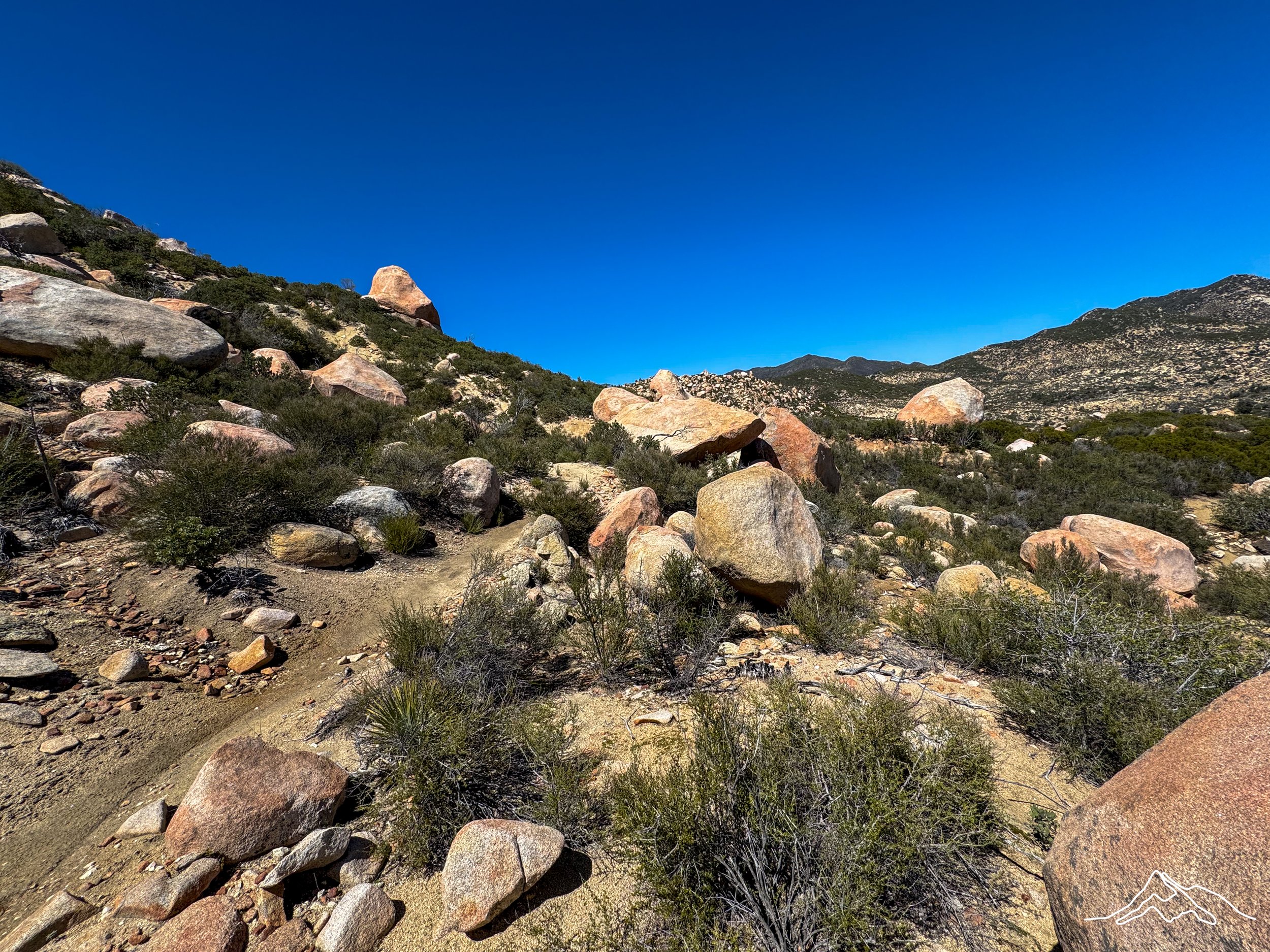
After the snow, it was pure proper desert. I continued to descend for the remainder of the day mostly on loose rocks. Passing the 200 mile mark was an exciting part of the day! Eventually we found a campsite that others joined us at and it was great to chat with folks for a bit longer than in passing on the trail. This campsite was absolutely stunning set within rocks and a snow covered San Jacinto in the background.
Day 20 Part 1: Mile 201.7 – 209.5
Trail Daily Miles: 7.8
Total Daily Miles: 7.8
Total Trail Mileage: 209.5
Elevation Gain: 215 ft
Elevation Loss: 2229 ft
Weather: Sun, Hot
Overall Day Sentiment: Why so hot?
I woke up early and got on the trail by 6am because it was clear there was going to be strong heat for the day. It was also a long water carry which adds an extra motivation to be up packing by 5:15am.
The first portion of the day and rounding out this section was primarily down again as we needed to continue to get off of the San Jacinto range. Eventually I walked through quite literally a neighborhood on a paved section all the way to a river wash going under the I-10 underpass. There is historically trail magic here, but we were a smidge early as the trail angels were not set to arrive for a few hours.
Thankful for a reprieve from the sun, I was thankful for my sun umbrella and the highway underpass for shade! At a seemingly inconsequential point, PCT CA section B was now complete!
The remainder of this day on trail will be covered in the next section post!
Thank you so much for all the support – I am having a fantastic time out here!
Xoxo Leeann