Pacific Crest Trail Hike: OR & WA Section E & F – Mile 1848 – 2094
Pacific Crest Trail Hike: OR & WA Section E & F – Mile 1848 – 2094
Hello all! These sections were full of ups and downs that reminded me of a few key lessons. I was amazed at how my body had gotten so strong and could do so many miles in a short period of time while crossing the 2000 mile mark. I accomplished my first 40-mile day and followed it up a few days later with another near 40-mile day. New groups of hikers allowed for some social interactions with folks I hadn’t interacted with before while some friendships came to a close. Overall in these sections, I began to dig deep and rely on my mental fortitude and grit – because it would have been easier to quit. I am thankful for the mental preparation work I did prior to starting the trail and believing in myself.
PCT OR & WA Section E & F Summary
Statistics:
Days: 9
Full hiking days: 6
Zeroes: 1
Neros: 2
Total Trail Miles Hiked: 203
Total Miles Hiked: 205.5
Trail Elevation Gain: 28,827 ft
Trail Elevation Loss: 30,701 ft
Highlights:
40-mile day. 2000 miles.
I covered so many miles in these sections! If only counting my full hiking day miles, I averaged over 32 miles per day.
Bend, Oregon was a great trail town and stop over for a zero day.
Bags being back near me! Couldn’t wait to hike with her again!
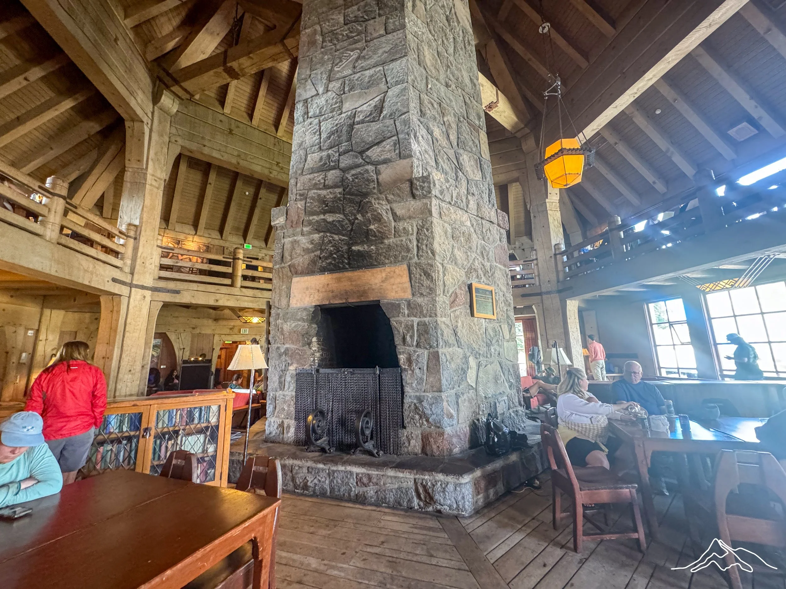
Timberline Lodge was as architecturally neat as I hoped.
Abundance of trail magic kept spirits higher than they would have been otherwise.
Lowlights:
Poor communication lead to a disappointing second half of this section.
My first interactions with another hiker that made me uncomfortable as a solo woman.
Reflection on the life I thought I had before the trail.
PCT OR & WA Section E & F Detailed Version
Day 121: Mile 1907.6 – 1934.2
Trail Daily Miles: 28.1
Total Daily Miles: 28.3
Total Trail Mileage: 1924.2
Elevation Gain: 3958 ft
Elevation Loss: 3097 ft
Weather: Hot, Buggy
Overall Day Sentiment: Thankful for trail magic and swimming spots!
I very begrudgingly left Shelter Cove Resort on Odell Lake and continued hiking. As previously mentioned, there was a large bubble of hikers at Shelter Cove, so hiking out this day I knew that I would see many along the way. The initial few miles of the day were on a decent incline through a ski area. This was a strange juxtaposition with the increased wildfire haze that developed overnight knowing that this is going to be completely covered in snow in a few months.
At about 12 miles in for the day, I stopped to have snacks and a water break with Yeti, FlipFlop, and Milky Way at a beautiful small lake, Bobby Lake. It was once again a warm day so it was prime swimming time. This was a great spot with a few campsites and I would recommend it to anyone in the area! This began a trend that would last throughout these sections of seeing groups of overnight backpackers (non thru-hikers), which was enjoyable to meet other people outside of the thru-hiking community.
One of the big highlights of the day was elusive “Big Trail Magic” coming up in 7-8 miles (at my mile 20 mark for the day). It had been posted on FarOut (the mapping application that most thru-hikers use) at a specific location. After the swim and snacks at Bobby Lake, it was exciting to have another destination in mind at Charlton Lake. There were some steady climbs in between my stopping points, but it was a treat once I arrived! Two former thru-hikers, including Magnet who now owns a gear company, had a great set up for hikers. It was in fact “big trail magic” that provided a lot of hikers with full meals. That giant bubble of hikers eventually had descended and I counted 20 people there during the time I was. It was a real gift and a pick-me-up for a long day, thank you!
Directly after the trail magic set up was the worst burn scar that I had walked through up until this point. Many of the other burned areas had some regrowth from years passed or there were some trees that remained. But this area? This was completely incinerated and was desolate. I’ve included some pictures below but nothing could actually prepare me for the feeling of walking through this region. To go from swimming in lakes surrounded by forests to this barren wasteland was powerful.
Towards the end of the day, I entered into the Three Sisters Wilderness which had been on my list of places to go for sometime. I was listening to a great audiobook and had reentered into a forested zone. Eventually I found Yeti and we camped at a great spot on Brahma Lake. I was treated with another swim AND a delicious sunset.
Day 122: Mile 1934.2 – 1959.8
Trail Daily Miles: 25.6
Total Daily Miles: 25.8
Total Trail Mileage: 1959.8
Elevation Gain: 3107 ft
Elevation Loss: 2674 ft
Weather: Hot, Buggy
Overall Day Sentiment: Another day
Yeti and I had been talking about doing a 40 mile day in this section, because… why not? Originally it was going to be this day, but because of the bugs and the heat – I had slept terribly. At our 4am alarm to prepare for the robust hiking day… we decided more sleep was the better move. So I “slept in” until after 6am and didn’t get moving until just after 7am. After looking at the maps, I picked the 40 mile section for the following day which meant this day just had to be 25ish miles so a 7am departure was suitable.
This was an overall non eventful day with little elevation gain, decent water sources, and nothing out of the ordinary. There was an option at one point to go into Elk Lake which had a resort and a restaurant, but was a mile or so off the trail. With the planned 40 mile day the following day, it felt silly to add extra miles the day prior. But at the Elk Lake junction, I was surprised with trail magic from another former thru-hiker! He was just getting set up when I arrived and we chatted for some time. I never drink pop/soda in real life but on the trail? Please.
There was a solid climb to wrap up the day with a small descent heading into camp. As I descended, the bugs came out in full force. I arrived to see Yeti setting up his tent and partially fighting for his life against the bugs. I put on my full mosquito gear (despite the heat), filled up my water, set up my tent, and never left it again. As I was falling asleep, small bits of rain began which made me throw on my rain fly urgently. Because of the heat, I had generally been sleeping without it, but I did not want to get my sleeping gear wet – so sweat I shall.
Day 123: Mile 1959.8 – 2000.1
Trail Daily Miles: 40.3
Total Daily Miles: 40.3
Total Trail Mileage: 2000.1
Elevation Gain: 5405 ft
Elevation Loss: 6561 ft
Weather: Hot
Overall Day Sentiment: 40 mile day!
When one plans to do a 40 mile day, I hoped for the best but knew I technically could quit at any time. Yeti and I set out at 5:15am, just at first light with our headlamps on and the miles came easy. Sunrise near the Sisters mountains was plain special. Large meadows with wildflowers started off the day on a high note. One thing I planned to do differently this day was to eat as much as I could. I knew I would arrive in Bend the next day, so I ate probably 40% more calories than usual. No surprise, but it definitely helped.
Around mile 13, I was still feeling great and we were making good time! We stopped for a break at Obsidian Falls which was properly named as there were shards of obsidian everywhere. I again ran into a lot of day/1-night overnight hikers that were so complimentary of what I was doing, how far I had come, and what I had accomplished thus far. When you are surrounded nonstop by other thru-hikers, it is easy to lose sight of how actually amazing something like attempting a thru-hike is.
After that break, we began to run into some of the infamous lava fields. Fields may be the incorrect term because these were some lava rock mountains that I had to traverse. There was one specific section that was just lava rock switchbacks in a canyon. I remember being at the bottom and looking up and thinking there is absolutely no way that is the trail. Only to be brought back to reality by seeing a small Yeti in the distance at the top – welp I guess that IS the trail.
There are two highways in this section that run into Sisters/Bend; McKenzie Pass or Santium Pass. I had originally planned on jumping off at McKenzie pass but with the Shelter Cove shakeup and the 40 mile challenge – we head to Santium Pass.
At the MacKenzie Pass highway crossing, I was greeted by the sweetest of all trail angels, Jaclyn. Not only was she one of the most fun and interesting people, she also brought a wonderful assortment of fresh fruits and veggies that I always desperately craved. We bonded over international travel with the intent to see wildlife and it felt great to meet a kindred spirit. I ate a full meal here in preparation for the remaining 15 miles.
The first 5 miles after McKenzie Pass were quite comical – it was a lava rock ascent… for the whole 5ish miles. At some point I was just amazed a) at the geological events that took place to create this and b) that there was remotely a trail here. This ascent provided some wonderful views of the surrounding peaks and it was easy to stay motivated and positive.
Once I hit 34 miles and completed another ascent is where my energy and mood took a tumble. I took too long of a break (20 minutes) and I realized that it set up me to arrive to camp in the dark. I have night hiked a bit but it is not my favorite and definitely not what I want to do alone. So my solution? To start jogging on the trail. Jogging (not to be confused with actual running) with a large pack on my back was more fun that I realized and I ended up jogging on and off for the remaining 6 miles. This improved my time from 18:00 min/mile to 11-13 min/mile which added up enough to let me arrive at camp not too long after dark. Though the last mile was a smidge spooky because it was once again forested and I had reached a level of tired that I began seeing things.
I arrived at camp to a tired but proud Yeti already there at around 9:15pm. I cannot believe that I/we did a 40 mile day! Do I ever want to do it again? Not really. But I guess I also said that about my first 30 mile day 🙂
And to those that are curious, 40 miles took me 12 hours and 48 minutes of moving time.
Day 124: Mile 2000.1 – 2001.9
Trail Daily Miles: 1.8
Total Daily Miles: 1.9
Total Trail Mileage: 2001.9
Elevation Gain: 138 ft
Elevation Loss: 132 ft
Weather: Warm, Smokey
Overall Day Sentiment: 2000 miles?!
With under 2 miles left until the highway in which I would head into Sisters/Bend, Oregon, I slept in a bit aka got moving after 7am. Surprisingly my legs were fine? I was expecting the hiker hobble to be exponentially worse but it remained the same and felt like I had for the past few months. Because I arrived in the dark, I didn’t realize that our camping spot was directly near the 2000 mile marker! It was such a treat to take a picture next to it and know that I had made it this far. I understand that with the fire closure skips that I hadn’t actually hiked 2000 miles, but it was significant nevertheless.
When starting the trail, 2000 miles seemed completely unattainable. Considering I had only ever backpacked a total of 30 miles (2 different occasions), it felt like a pipe dream. Not only had I done 40 miles, but also the 2000 mile marker? Completely surreal.
The trail was lined with berries as we headed to the highway and the mosquitoes had wained which meant I actually got to slow down to gather them. I eventually made it to the highway and a group of 6 of us got a hitch into Sisters. Yeti and I then got another hitch all the way into Bend – with someone who had never picked up hikers before! I am thankful for the kindness of strangers even when I was looking my most raggedy and smelled horrible.
Once in town, the list of chores commenced. Breakfast first, obviously, but then a trip to the laundromat was in order. I also went to the post office to find that though my shoes HAD arrived, they were still being processed and would not be available for pick up until the following day. Luckily I had planned on a zero in town, but if I hadn’t ..my poor feet. The lava rocks from the day prior had done enough damage to my feet with my shoes that had over 500+ miles on them so I desperately needed the new ones in order to continue hiking.
When I arrived at the hotel with clean clothes and a fresh shower – I had an absolute amazing nap. Though when I woke up I thought that I was fine from my 40 mile day, the banger of my nap may have indicated to me that I was more tired than I realized. That night, Yeti and I met up with another group of hikers that were in town for dinner. This was the same group that I met up with in Ashland so it was great to see them again, except with no tequila this time.
Day 125: Mile 2001.9
Trail Daily Miles: 0
Total Daily Miles: 0
Total Trail Mileage: 2001.9
Elevation Gain: 0
Elevation Loss: 0
Weather: Hot, Smokey
Overall Day Sentiment: I loved Bend!
My zero in Bend, Oregon was overall lovely! I woke up early and grabbed breakfast solo, which is something I learned to love to do. Afterwards, I then met up for coffee with another hiker – this would prove to be one of my biggest mistakes on the trail for a whole host of reasons, but more on that later. I went to REI to look for a new sun hoodie as mine had gotten decimated with holes on the back. REI was mysteriously out of all brands of sun hoodies in addition to being out of stock of many other items. As this was a beacon for me prepping for the rest of the trail, it was a disappointment.
Several of us (me, Prick, Yeti, Bags, River, and more) met at Fermentation Brewery for lunch and because Bags was back! She caught up after her time away from the trail and I could not have been more excited to see her! Later on Yeti and I went to a movie to which I was primarily driven to go to because I wanted popcorn. I was finally able to pick up my new shoes at the post office which was my big win of the day! Prick, Bags, RedRoy, and myself went out to dinner at Bend Brewing and met up with Bags’ brother, which was a real treat. Prick and Bags were staying an extra day in Bend, so I would catch up with them after my time in Portland.
Day 126: Mile 2001.9 – 2011.9
Trail Daily Miles: 10
Total Daily Miles: 10.2
Total Trail Mileage: 2011.9
Elevation Gain: 1832 ft
Elevation Loss: 1203 ft
Weather: Hot
Overall Day Sentiment: Should I just quit?
Bend, Oregon is known as a trail town, but does sit a solid 45 minutes away from Santium Pass aka my destination for getting back on trail. The exit from town was a complicated and difficult one that had me contemplating if I should even get back on trail. I crossed the 2000 mile mark, so did I need to go further?
I missed the bus system in the morning and did not feel comfortable hitch hiking alone back to the trail. So I took my time and went out to breakfast with Prick and Bags. I found a tiny gear shop that had some sun hoodies to replace mine. This also was a terrible mistake as the fabric ended up being awful. After meeting up with another hiker, the one from coffee the day prior, we eventually got back to the trail.
As it was already mid afternoon by the time I started hiking, I only did 10 miles, which did set me up well for the next day. This area was beautiful to hike through with highlights such as Three Finger Jack, a shield volcano that had a striking presence. I ran into some new section hikers along the way dealing with blisters and it made me realize how far I had come and they had my deepest sympathy. When myself and the other hiker arrived at the desired campsite, it was quite full. The majority of folks were out for a quick overnight as this section of trail is relatively accessible from a few towns. The campsite was near a pond which was wonderful for water source purposes but not great for the impending condensation that would soak my tent.
This was my real first indication that I should not have hiked out with this specific person based on some inappropriate comments they were making. It was the first time on trail, 2000 miles in, that I felt uncomfortable as a solo woman.
Day 127: Mile 2011.9 – 2042.7
Trail Daily Miles: 30.8
Total Daily Miles: 31
Total Trail Mileage: 2042.7
Elevation Gain: 5618 ft
Elevation Loss: 6006 ft
Weather: Warm
Overall Day Sentiment: Gotta keep going
I woke up to a completely condensation soaked tent with everything inside damp. The day was slated to be sunny so I knew that I would be able to dry everything out at some point. I had planned to do a decent day around 30 miles so that I could get to Portland, Oregon quickly. I have a dear friend that lives there and after the day prior, I was ready for some off trail comfort.
Despite my feelings, I alerted the person I had hiked out with and camped with that I was planning to do a 30 mile day (at least) and they decided to as well. This person had “forgotten” to charge their external battery bank and planned to rely upon my battery banks to charge their items. This meant I had to conserve and was unable to listen to my music or audiobooks in this section. Great. So not only did I feel uncomfortable, I also was unable to listen to what I liked in the afternoons.
Hiking was relatively smooth and I ended up having lunch by a beautiful pond. I laid out my tent and sleeping items to dry, which worked quickly. While at the lunch spot, there were other section and weekend hikers there. At over 2000 miles in, they had many questions for me which I am always happy to answer. I am thankful anytime I get asked questions because a) I love to share my story b) sharing my story gives other people perhaps a bit of confidence and c) the questions typically come from a place of awe.
On this day, I entered and crossed through the Mount Jefferson wilderness area. This is the second highest volcano in Oregon (behind Mount Hood) which meant it provided views the entire day. The area around the mountain was covered in wildflowers again only proving that I was following the flower bloom north. There was also snow at the top of the climb! These small snow traverses and river crossings brought me back to good times with my Sierra crew. This was in direct contrast to my current hiking situation in which the uncomfortable comments from the other hiker continued throughout the day.
After going through more surprise lava rock fields, I arrived at my designated camping spot for the night about an hour ahead of the other hiker and I realized that I needed to make a plan. I had two battery banks and determined that I would sacrifice one of them to move ahead of this person. That evening, I gave this person my second battery bank and made plans for a 38 mile day the following day to put some space between myself and them.
Day 128: Mile 2042.7 – 2080.2
Trail Daily Miles: 37.5
Total Daily Miles: 38.2
Total Trail Mileage: 2080.2
Elevation Gain: 3604 ft
Elevation Loss: 6106 ft
Weather: Warm
Overall Day Sentiment: 38 miles is awfully close to another 40 haha
Waking up and getting out of camp early was top priority for me for my planned big mile day. Much like the day prior, my tent was completely soaked through with condensation. It was slated to be another sunny/dry day so I figured I could dry it out at some point again even with the miles I had to cover. Initially I went through a large burn zone that lead the trail near Olallie Lake Resort. This is a stop for many hikers but I had to keep going past.
This day also went through the Warm Springs Reservation which was a beautiful forested area. The section through the reservation was relatively flat which I used as my trail running practice course. I discovered that though I previously detested running, I enjoyed moving at a quicker pace with this level of fitness. I had already determined that I hated the new sun hoodie and that I would be picking up a new one once arriving in Portland so I didn’t particularly care if it was worn out by vigorous activity.
Once again there were many hikers in this section; both thru-hikers and section hikers. I ran into people I had not seen for some time and met new people that I had been hiking near and never known it. There were also signs for trail magic at a local horse camp – a camp specifically meant for horse back riders which was accessible from a main road. It was a great bit of extra energy to round out my day.
I had plans to camp on Timothy Lake and oh boy it was busy because it was a Saturday. When thru-hiking it is easy to forget what day of the week or what the actual date is because you categorize your days by miles/sights/towns. I had to walk a few extra miles further than my body wanted to because of the full campsites. But I eventually found an idyllic site directly on the lake as sunset approached. I never got a chance to dry out my tent and sleeping items so that was the first thing I did upon my arrival. Eventually I had company via Bundle, Turtle, and Sunflower. Though I don’t mind camping alone – it is nice to camp near folks. Well… some folks, unlike the other hiker from the previous two days.
Day 129: Mile 2080.2 – 2109.1
Trail Daily Miles: 28.9
Total Daily Miles: 30
Total Trail Mileage: 5165 ft
Elevation Gain: 5165 ft
Elevation Loss: 4922 ft
Weather: Warm
Overall Day Sentiment: Proud of myself
Today was entering the Mount Hood wilderness AND going to visit the famous Timberline Lodge. The breakfast buffet was a thing of legend but word was that the lunch buffet was now superior. Bundle and I decided to have lunch together and arrive at Timberline for a 1:00pm time. I quickly made a reservation when I got service because it was a Sunday so there was no telling how many tourists would be in the area. We had 19 miles to go to get there with the majority of the elevation for the day so we had to get moving. We hustled for awhile, had a long snack break, then continued on.
The trail crosses Barlow Pass – which is technically where this section ends, but I will continue talking about the rest of my hiking day. Barlow Pass is significant to me because the Autumn prior I had visited the area in hopes of finding a new home. I had settled on Hood River, Oregon being my destination when things in my personal life went haywire only a month later. There is a picture of me at the bottom of this post pointing to a PCT tree blaze. I remember this day vividly and I was filled with such hope of eventually hiking the trail while being so close to my “new home”. Obviously the former happened and now I was nearly 2100 miles into the trail which filled me only with pride. There was also a pang of melancholy that struck me simultaneously because life is so different than I thought it would be for over a decade. These conflicting feelings reminded me that I was out here for a reason and that I had thoroughly learned to love/trust myself more than ever possible.
I crossed the highway of Barlow Pass and headed the final miles towards Timberline Lodge. This was a climb.. partially in sand. I didn’t think that I would be attempting to run uphill with my pack on in sand to get to my lunch reservation but here I was. Bundle was only a bit in front of me but we made it at 12:50pm. The amount of tourists that were around the area was completely overwhelming on a Sunday. It is such a neat spot that I understand why it was busy, but after living in the woods for however many months – it is too stimulating.
Lunch was good, but as a gluten free gal, not as filling as I had hoped. There were a ton of hikers there that we all practically took over the main area and more than half the dining space. After hanging out and charging my SOLE battery pack (still sad I only had one after my sacrifice), I had a box to pick up. I originally had anticipated going all the way to Trout Lake, WA and then going to Portland, OR for a few days – but people and plans change so I had sincerely overpacked. So I had an extra 3 days of food which added ~6 useless pounds to my pack.
I continued hiking around the substantial and amazing Mount Hood for the remainder of the day. For this part, the PCT also is the Timberline Trail, a trail that circumnavigates Mount Hood. This mountain was much more robust than I realized so walking around it for hours on end was humbling. I eventually got to an area with other hikers already camped out and though I desperately wanted to stay with one of them, I decided to give them and me space. I camped solo near a river in a perfect spot for 1 tent. It was again a reminder that being alone and enjoying solitude has nothing to do with loneliness.
xoxo
Leeann/Kanga