Pacific Crest Trail Hike: CA Section E – Mile 454 – 566
Pacific Crest Trail Hike: CA Section E – Mile 454 – 566
Hello from the trail! This section was full of my lowest moments with actual contemplation of quitting the trail. I had to dig deep and find the motivation for being out here. It had some of the most frustrating trail I’ve run into yet, day after day.
I’m still out here, several sections down the way – so I was able to turn it around! I’m heading into a very remote section now so it will be a bit before my next post.
PCT CA Section E Summary
Statistics:
Days: 7
Full hiking days: 5
Zeroes: 2
Neros: 0
Total Trail Miles Hiked: 112.2
Total Miles Hiked: 114
Trail Elevation Gain: 18,184 ft
Trail Elevation Loss: 16,917 ft
Highlights:
This section was the second half of a hard 9 day push. I did 196 miles in 9 days with no days off, averaging nearly 22 miles per day. I’m so proud of my body!
The hiker community both on and off trail continues to amaze me.
Lowlights:
This section was generally a slog that was hard to get through mentally.
Really contemplating getting off of the trail after years of dreaming about this was a harsh reality.
PCT CA Section E Detailed Version
Day 36: Mile 454.7 – 474.0
Trail Daily Miles: 19.3
Total Daily Miles: 20.0
Total Trail Mileage: 474.0
Elevation Gain: 4136 ft
Elevation Loss: 2963 ft
Weather: Sun
Overall Day Sentiment: An okay day
I had camped the night before at Serenity’s Oasis in Agua Dulce, so while I was in town – I may as well go out to breakfast! Bobcat, Canuck, Squirrel, and I grabbed a quick meal before heading out. Links and Wavy joined for a bit as well, which was nice as they were heading off trail soon for a family event. This was one of the first times that our group of four discussed a plan the Sierra Nevada mountain range, which was exciting!
After getting a late start, I hit the trail and it was already warming up. Luckily there was a decent amount of water on trail so a super heavy water carry was not needed. There was a large climb that seemed to go on forever, but I was rewarded with some fantastic views. I also received some delicious Michigan cherry treats from Cherry Republic in my resupply box from my at home Support Person – thank you!
Canuck and Squirrel were ahead of us and grabbed a well placed camping spot on top of a ridge. It was a beautiful view but came at the cost of a lot of wind overnight. As we would all soon discover, that wind was here to stay.
Day 37: Mile 474.0 – 498.2
Trail Daily Miles: 24.2
Total Daily Miles: 24.8
Total Trail Mileage: 498.2
Elevation Gain: 4486 ft
Elevation Loss: 3050 ft
Weather: Sun
Overall Day Sentiment: A long, but okay day.
We all decided to start this day early in preparation for potential heat. There was a solid amount of climbs and ascent that made the early departure worth it.
This day was a long just okay day. There was a lot of frustrating trail that wound through burn areas which makes it completely exposed to the sun. This also allows for the dreaded PoodleDog bush plant, described in the last post, to thrive. There was a large section of this day where I seemed to be tip toeing the trail/turning sideways to avoid contact with it.
We all had chosen an established campground on the map earlier in the day, not fully realizing that it was 0.25 miles off trail, going straight up. After an arduous day of trail miles, that is the last thing I wanted to do. Alas, we made it and the site had trash cans and a pit toilet. It was another windy night that tested my tent pitching skills!
Day 38: Mile 498.2 – 517.6
Trail Daily Miles: 19.7
Total Daily Miles: 19.8
Total Trail Mileage: 517.6
Elevation Gain: 2794 ft
Elevation Loss: 4839 ft
Weather: Cold, Sun, Hot, WIND
Overall Day Sentiment: I can’t believe I made it to Hikertown!
After a windy night, I happily packed camp up to get out of the continued gusts. I was crossing a big milestone in the next few miles and wanted to get there! PoodleDog bush persisted and blocked the actual 500 mile mark for a few miles so the marker was around 502.
Other than the 500 mile mark, it was an average hiking day in the desert. The water carries were not too bad, but there wasn’t anything super interesting either. We were all just looking forward to getting to Hikertown, an iconic PCT spot. This place should be Googled if you are interested as it is hard to describe.
When we arrived at Hikertown, we were greeted by a wonderful new(ish) owner/host, Marta. What an absolute delight of a person! She was kind, generous, and clearly cared about the hiker community. She showed us the best camp spot to set up *out of the wind (*dealing with 15mph rather than 30mph) and gave us a small tour of the grounds upon arrival. Treat her well, hiker community – she is a special one!
There is a tiny market, Neenach Cafe, down the street that shuttles hikers to and from Hikertown. There is some prepared food but also decent resupply and hiker treats. After some snacks, we were satisfied to go back to Hikertown.
There were other hikers congregating there, which was a treat! I met some wonderful folks including 3 others from Michigan! Of course we had to play a quick game of euchre before turning in for an early night. The early night was due to completing the LA Aqueduct in the morning!
To the other hiker that set up so close you were nearly in my tent and then proceeded to talk on the phone until past 8pm, know that I have not forgotten and you owe me an hour of sleep!
Day 39: Mile 517.6 – 545.1
Trail Daily Miles: 27.4
Total Daily Miles: 27.7
Total Trail Mileage: 545.1
Elevation Gain: 3101 ft
Elevation Loss: 1622 ft
Weather: Sun, Wind
Overall Day Sentiment: Glad that is over.
The LA Aqueduct is an infamous hot and flat section of the trail that is essentially a 17 mile road walk along an exposed waterway/giant pipe/an underground river. I departed camp at 3am meaning I woke up and started getting ready at 2am. I had bought a lot of candy in preparation to reward myself every hour for this journey. This turned out to be a bad idea as I have been eating relatively healthy on trail so it was just a sugar crash. Alas, every bit tasted good at least!
At the end of this brutal 17 miles, you begin to enter wind farms. It was quite windy this day and meandering through the turbines was a surreal experience. They are much larger than I thought and sound like an airplane. I tried to listen to an audiobook to keep from going mad, but also had to be on the lookout (listenout??) for rattlesnakes. It was a near deafening experience that was also graced with a lot of steep ascent. Oh and a long water carry! Fun!
After our last water source of the day, it was getting hot going in and out of exposed canyons. Canuck and Squirrel were ahead of Bobcat and I all day and were just continuing to speed along. Despite our best efforts, we called it quits at the bottom of a canyon before another giant ascent at 27+ miles. Surprise surprise, it was windy at night.
Day 40: Mile 545.1 – 566.5
Trail Daily Miles: 21.4
Total Daily Miles: 21.7
Total Trail Mileage: 566.5
Elevation Gain: 3667 ft
Elevation Loss: 4443 ft
Weather: Sun, WIND
Overall Day Sentiment: I may quit
This day started early similar to the day prior, a 3am departure time. There was a large climb (2000+ ft) straight away, which I did the in the dark. I realized that doing giant switchback climb is a bit easier when I couldn’t see the impending steepness.
At mile 549, there was a water cache and general trail magic set up. Since we stumbled upon this at 5am, there were Christmas lights glowing in the dark so it was mildly eerie. It was a sweet spot that is normally popular during the day! A hiker had been cowboy camping near the area and scared the living daylights out of Bobcat and I when a third party just joined out conversation of nowhere. A funny tiny anecdote that I will continue laughing about for awhile.
This is where the day went somewhat downhill. The remainder of the day was spent winding throughout several wind farms. Do you know why there were so many wind turbines? It is because it was in fact very windy with an additional wind advisory that had 30mph sustained winds with 50+ mph gusts.
The last 8 miles of the day were beyond frustrating and I cried nearly the whole time. It was the first time I truly asked myself “why am I out here” and reminded myself “you wanted to be here!”. I got off the major descent and had a 1 mile road walk and wanted to quit. It was the first time that I actually thought about quitting but it is always a good rule of thumb to never quit on a bad day. We got picked up by a trail angel that completed the PCT in 2016 and my mood immediately lifted!
Day 41 & 42: Mile 566.5
Trail Daily Miles: 0
Total Daily Miles: 0
Total Trail Mileage: 566.5
Elevation Gain: 0
Elevation Loss: 0
Weather: Sun
Overall Day Sentiment: Thankful for rest days, the post office, and free hotel breakfasts.
I ended up taking a double zero in Tehachapi which was relaxing. There was a laundry list of chores to do including resupplying food, laundry, post office stops, and more. I also had been having backpack troubles and got a new pack sent here. Unfortunately it was too small, so I had to return it and have a new, properly sized one, sent to the next town stop. I ate some great food, spent time with wonderful people, and got myself back in order to hit the trail.
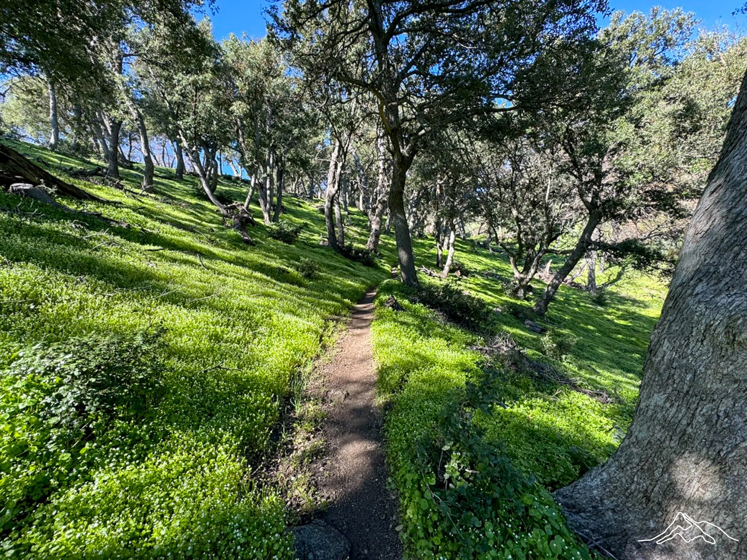
Enjoy pictures from the PCT CA Section E!
xoxo Kanga/Leeann